Salkantay Trek: A Complete Guide to the Apu Route
 By PumAdventures
Salkantay gets sold as “the alternative to the Inca Trail,” and that framing does it a disservice in both directions.
It suggests Salkantay is what you settle for when the permits are gone. It also badly undersells the difficulty: people book it as a consolation route and then find themselves crossing a 4,600-metre pass on day two after a night at 3,850 m, which is harder than anything the classic Inca Trail asks of them.
The two routes are not competing versions of the same walk. The Inca Trail is a ceremonial road built by the Inca state, paved in stone, arriving at a citadel. Salkantay is a mountain crossing — you walk under a 6,271-metre peak, over a high pass, and then down through three ecosystems into coffee country. One is architecture. The other is geography.
This Salkantay trek guide covers the route day by day with real altitudes, an honest account of the difficulty, how it compares with the Inca Trail and with Ausangate, and — because we’re a ceremony operator as well as a trekking one — what the mountain you’re walking under actually means to the people who live beneath it.
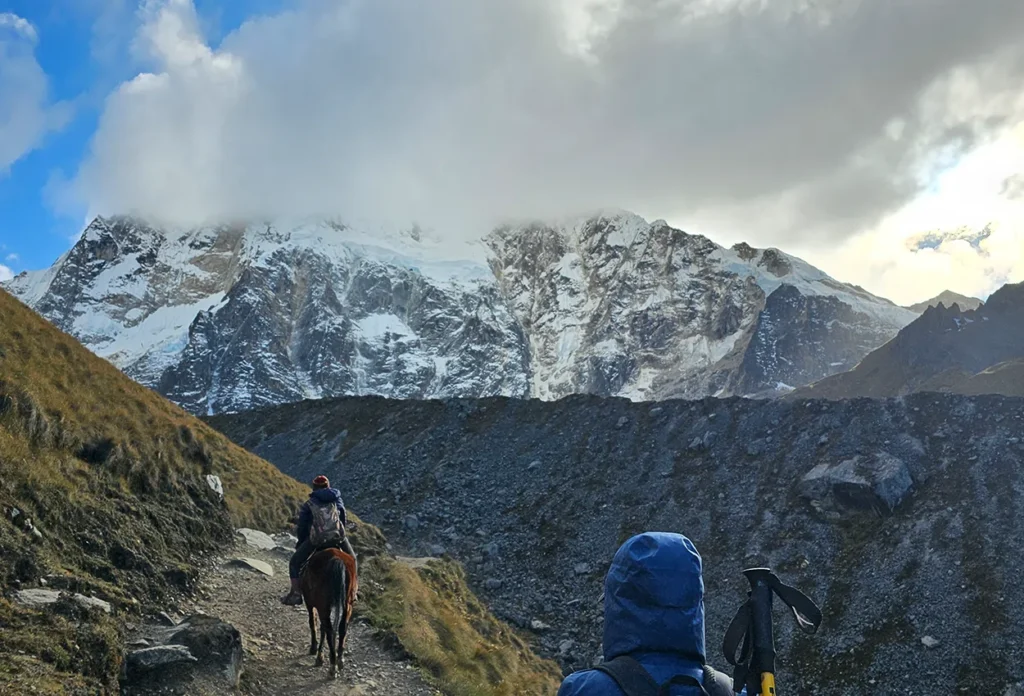
Table of Contents
The Mountain, Before the Route
Most trekking guides start with the itinerary. Start with the mountain instead; the route only makes sense once you know what you’re circling.
The numbers
Salcantay stands at 6,271 m — some sources give 6,264 m, and a 2013 GPS reading recorded 6,279 m, which tells you something about how these figures are arrived at.
It is the highest peak in the Vilcabamba range, the twelfth-highest mountain in Peru, and the thirty-eighth highest in the Andes. It sits roughly 60 km west-north-west of Cusco. It was first climbed on 4 August 1952 by a French-American expedition — recent, as these things go, and a reminder that the summit and the trek are entirely separate propositions.
You do not climb Salkantay on the Salkantay trek. The route crosses a pass on its flank. Summiting is a technical mountaineering objective requiring glacier travel and experience, and it is not what anyone is selling you.
What the name says
Salkantay comes from the Quechua sallqa — wild, uncivilised, savage, and in some renderings invincible. It is usually translated as Savage Mountain.
That is not a marketing flourish applied by tour operators. It is how the mountain was named by the people who lived under it, and it tells you the relationship: this is not a benevolent peak. Andean tradition treats the great Apus as powerful rather than kind, capable of being offended and capable of consequences. A mountain called wild is a mountain you approach with care.
Apu Salkantay
Documented. Salkantay was regarded as one of the principal deities controlling weather and fertility across the region west of Cusco. Not one sacred mountain among many — a major one, named in offerings across a wide territory.
And here is the detail that connects it to everything else. Seen from Machu Picchu, the Southern Cross appears above Salkantay’s summit during the rainy season — an alignment the Inca associated with rain and fertility. The mountain is not incidental to the citadel’s position. It is part of why the citadel is where it is, a point we take further in our reading of Machu Picchu’s sacred architecture.
So when you walk the Salkantay route, you are moving through a landscape that the builders of Machu Picchu were watching from forty kilometres away. Our guide to the Apus sets out how these relationships work, and why which mountains you name depends entirely on where you’re standing.
Salkantay is still named in despachos throughout the Cusco region. Not as heritage — as current practice.
The Route, Day by Day
Our five-day Salkantay trek covers roughly 58 km with camping on the first three nights and a hotel in Aguas Calientes on the fourth. Longer variants run up to 70-odd kilometres; shorter four-day versions compress days three and four.
Altitudes below are the figures we’d stand behind. Published numbers vary between operators by a hundred metres here and there, and where sources disagree we’ve said so.
Day 1 — Cusco to Soraypampa, and Humantay
A road transfer to Mollepata at about 2,900 m, then on toward the trailhead and up to Soraypampa at around 3,850 m, where you camp.
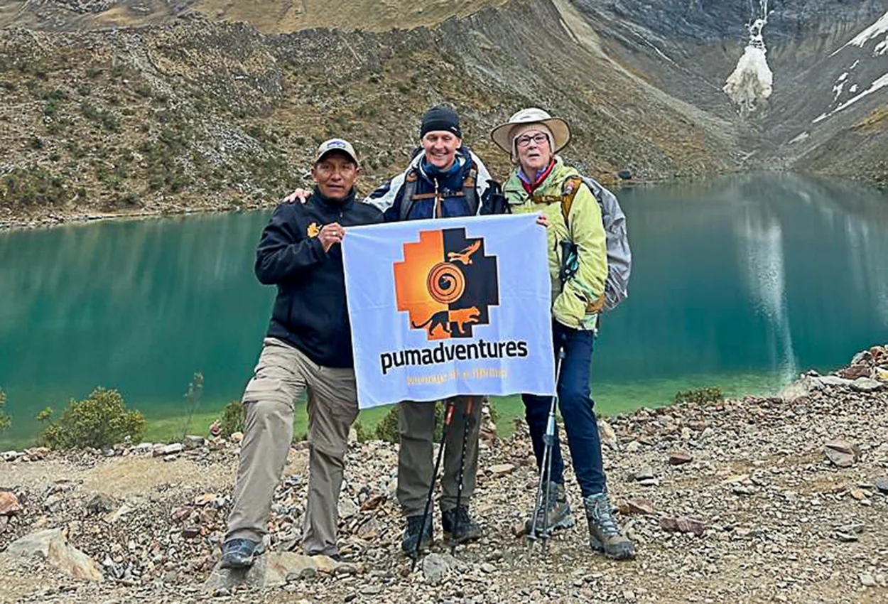
The afternoon is an out-and-back to Laguna Humantay, a glacial lake sitting at roughly 4,200 m beneath Humantay mountain. Three hours or so, steep in places, and the point of it is acclimatisation as much as scenery — a climb to 4,200 m and back down to sleep at 3,850 m is textbook preparation for the pass tomorrow.
The lake itself is an extraordinary colour and it is also, increasingly, busy: it’s reachable as a day trip from Cusco, so expect company. Go early or late if you want it quiet.
This is the night that decides your trek. You are sleeping at 3,850 m, higher than Cusco, and tomorrow you cross 4,600. If you feel bad here, say so to your guide before the morning rather than after.
Day 2 — The Salkantay Pass, and a very long descent
The big day. Roughly 22 km and nine hours, and one of the most demanding days in Andean trekking.
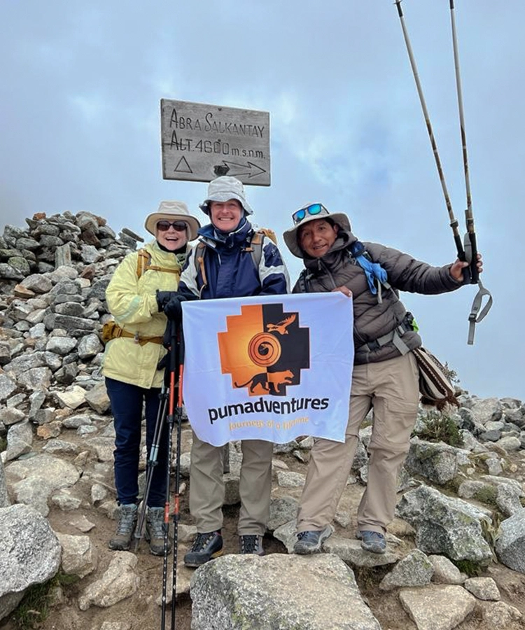
You climb from Soraypampa through the puna — high grassland, no trees, thin air — with Salkantay’s south face above you the whole way. The Salkantay Pass sits at about 4,600 m, with some operators including ours giving 4,650 m; either way you are on the roof of the trek.
The pass is the ceremonial point of the route, and you’ll find apachetas there — cairns of stones added to by generations of walkers. More on those below.
Then the day turns. From the pass you descend continuously — and steeply — for hours, dropping through cloud into a completely different world. You camp at Chaullay or Collpapampa, somewhere between 2,750 m and 3,000 m depending on the operator’s campsite.
Do the arithmetic on that. Up eight hundred metres, then down close to two thousand, inside one day. The climb is what people dread and the descent is what actually hurts them: quadriceps, knees, and the soles of your feet. Poles earn their weight here.
Day 3 — Into the cloud forest and coffee
Roughly 16 to 18 km, around six hours, and the day the trek stops being a mountain walk.
You follow the Santa Teresa valley down through La Playa toward Lucmabamba, camping at somewhere between 2,000 and 2,400 m. The vegetation thickens by the hour. Orchids, bamboo, hummingbirds, the smell of wet earth instead of cold stone.
This is coffee country, and a visit to a small family plantation is part of our itinerary — picking, de-pulping, roasting, drinking. Avocado, passion fruit and granadilla grow along the path. After two days above the treeline the sensory shift is genuinely disorienting, and most people rate this day far higher than they expected to.
Day 4 — Llactapata, and the first sight of Machu Picchu
About 15 to 18 km, six to seven hours, on original Inca path for much of the way.
You climb out of Lucmabamba to Llactapata, an Inca site on a ridge — and from there, across the Urubamba valley, you get your first view of Machu Picchu. Distant, side-on, and nothing like the postcard, which is precisely what makes it land. You see the citadel as a thing built into a mountainside rather than as an image you’ve already seen ten thousand times.
Then down to the Hidroeléctrica station and a walk or train along the rails into Aguas Calientes at about 2,000 m, and a hotel. A bed, a shower, and — if you have the energy — the hot springs.
Day 5 — Machu Picchu
An early bus up and a guided visit on Circuit 2, which is the route that gives you the classic upper view plus the Sacred Rock, the plazas and the Temple of the Condor.
Worth knowing what Circuit 2 does not include: the Temple of the Sun and the royal sector, which sit on Circuit 3. Our guide to the Machu Picchu circuits explains the whole system, and if the temples are a priority, a second-day entry is the only way to see both.
Train back to Ollantaytambo, then road to Cusco. Long day, and you’ll sleep.
The Altitude Profile Is the Whole Story
If you only look at one thing before booking, make it this.
| Point | Altitude |
| Cusco | 3,399 m |
| Mollepata | ~2,900 m |
| Soraypampa (camp 1) | ~3,850 m |
| Laguna Humantay | ~4,200 m |
| Salkantay Pass | ~4,600–4,650 m |
| Chaullay / Collpapampa (camp 2) | ~2,750–3,000 m |
| Lucmabamba (camp 3) | ~2,000–2,400 m |
| Aguas Calientes | ~2,000 m |
| Machu Picchu | 2,430 m |
Two features of that table matter more than the headline number.
The first is the spike. You go from sleeping at 3,850 m to standing at 4,650 m and back down below 3,000 m within about nine hours. That is a very large excursion, and it is why day two defeats people who are otherwise fit.
The second is the drop. Across days two and three you descend roughly 2,600 metres. Descent is the underrated injury risk in trekking — it loads knees and quads in a way that uphill doesn’t, and by day three a lot of people are limping rather than tired.
And the good news, buried in the same table: unlike the Inca Trail, Salkantay gets lower as it goes on. After the pass, altitude stops being the problem. You spend the second half of the trek breathing easily and warming up.
Salkantay Trek Difficulty, Honestly
Our own page rates it challenging, and that’s the right word.
What makes it hard:
The pass. 4,650 m with a loaded day either side of it. There is no way to make this easy and no shortcut past it.
The daily distance. Twenty-two kilometres on day two, then sixteen to eighteen on each of days three and four. The Inca Trail’s longest day is shorter.
The descent. Two thousand metres down on day two alone, much of it steep and loose.
Three nights camping, two of them cold. Soraypampa in the dry season can drop well below freezing.
And the thing nobody warns you about: the humidity change. You go from dry, cold, thin air to warm, wet, heavy air in forty-eight hours. It affects sleep, appetite and how your gear behaves.
Who should think twice. Anyone with a cardiac or respiratory condition, uncontrolled hypertension, or significant knee problems. The knee point is not cosmetic — a 2,000 m descent with a damaged joint is a genuinely miserable and potentially trip-ending experience. Talk to your doctor before booking this specific route.
Who manages it well. People who have walked consecutive long days before, who have spent two to three nights at altitude beforehand, and who use poles. Fitness helps. Acclimatisation helps more — altitude illness does not correlate with how fit you are.
What to do about acclimatisation. Arrive in Cusco or, better, the Sacred Valley at least two to three nights before you start. Our 7-day Cusco itinerary sets out the logic. Treat Salkantay as an eight-day commitment, not a five-day one.
Three Ecosystems in Five Days
The thing Salkantay has that no other trek to Machu Picchu matches.
High puna, days 1–2. Above 3,800 m. Bunch grass, cushion plants, ice-melt streams, no trees, enormous sky. Cold nights, fierce sun, and the sound of rockfall off the glacier at night.
Cloud forest, days 2–3. Between roughly 3,000 and 2,400 m. Trees appear, then epiphytes, then orchids and bromeliads on every branch. Mist that arrives and leaves within minutes. Hummingbirds.
Ceja de selva, days 3–4. The “eyebrow of the jungle,” below about 2,400 m. Coffee, banana, avocado, granadilla. Warm, wet, loud with insects. Not the Amazon — the transition zone above it — and the point where you realise how narrow Peru’s vertical bands are.
You cross all three on foot in under a week, which is a rare thing to be able to say about any trail anywhere.
The trek crosses protected areas administered by SERNANP, and the practical consequence is simple: carry out what you carry in.
Salkantay vs the Inca Trail
The comparison everyone wants, done properly.
| Salkantay (5 days) | Classic Inca Trail (4 days) | |
| Distance | ~58 km | ~42 km |
| Max altitude | ~4,650 m | 4,215 m |
| Nights | 3 camping + 1 hotel | 3 camping |
| Permit quota | None | ~200 trekkers/day |
| February | Open | Closed |
| Inca ruins en route | Llactapata | Many |
| Enters via Sun Gate | No | Yes |
| Ecosystem range | Puna → cloud forest → ceja de selva | Mostly cloud forest |
| Difficulty | Challenging | Challenging |
| Our price from | $1,499 pp | $1,500 pp |
The permit point is the practical one. Salkantay has no daily quota. You can book it weeks out rather than months, and it stays open in February when the Inca Trail closes for maintenance. That flexibility is the single most common reason people end up here — and it’s a perfectly good reason.
But choose it for what it is, not what it replaces. Salkantay is higher, longer and physically harder. What it gives you is a mountain and three ecosystems. What it doesn’t give you is the Inca road, the sequence of ridge-top ruins, or the arrival through the Intipunku — all of which belong to the Inca Trail alone. Our comparison of the 2-day and 4-day Inca Trail covers that side in detail.
If the stonework and the Sun Gate are why you’re coming, no amount of Salkantay scenery substitutes. If the mountain is why you’re coming, the Inca Trail will feel tame.
And Salkantay vs Ausangate
The other comparison worth making, and one we’ve already written up at length: Ausangate trek vs Salkantay trek goes through it properly, and our complete Ausangate guide covers that route on its own terms.
The short version, because the distinction is genuinely useful:
Ausangate is higher and harsher. It stays above 4,000 m for essentially the whole route and crosses passes above 5,000 m. It does not descend into forest. It does not end at Machu Picchu. It is the most physically serious of the three, and the most remote.
Salkantay is the transition trek. High enough to feel like a mountain crossing, and then it takes you down into warmth and green and finishes at the citadel.
In Andean terms, Ausangate and Salkantay are both major Apus — arguably the two great Apus of the Cusco region, one to the south-east and one to the west. Walking under either is not a neutral act in local understanding. If you want to understand that framing before you go, start with our piece on the Apus.
Still undecided across the whole catalogue? Our guide to which trek in Cusco to choose compares everything, and the full range is on the treks page.
Permits, Booking and When to Go
No permit quota. This is Salkantay’s structural advantage. There is no equivalent of the Inca Trail’s 500-per-day cap and no October scramble.
Lead time. Two to four weeks is usually comfortable. For June through August, give it six to eight — not because permits run out, but because good operators, horsemen and campsites do.
Best months. May, September and October are the sweet spot: dry enough for the pass, without June and July’s crowds and prices. June to August is peak dry season with the most reliable weather and the coldest nights — expect well below freezing at Soraypampa.
The rainy season is a real consideration here, more so than for ceremony-based trips. From November to March the pass can be genuinely unpleasant and the descent to Chaullay becomes slick and slow. February is the wettest month. Salkantay stays technically open, but we’d steer you toward the dry season for this specific route. Our guide to the best time to come to Cusco sets out the month-by-month picture.
Book Machu Picchu entry with the trek. The citadel has its own timed-entry and circuit system entirely separate from the trail, and it sells out independently.
What to Bring
The packing list that matters, rather than the generic one.
Poles, with rubber tips. The single most useful item on this route because of the descent. Metal tips are prohibited at archaeological sites.
Proper boots, already broken in. Two thousand metres of descent will find any flaw in your footwear, and it will find it on day two.
A sleeping bag rated to −10 °C. Soraypampa is cold. A −5 °C bag will leave you awake.
Layers for a 30-degree swing. You will be in a down jacket at dawn on day two and in a t-shirt sweating by day three.
Real rain gear, even in dry season. Afternoon weather on the pass does what it likes.
Sun protection that works at 4,600 m. High-factor sunscreen, a brimmed hat, proper sunglasses. The UV up there is brutal and people badly underestimate it.
Insect repellent for days 3–4. Nobody packs this and everybody wants it once they’re in the cloud forest.
Cash for the hot springs, tips and coffee at the plantation.
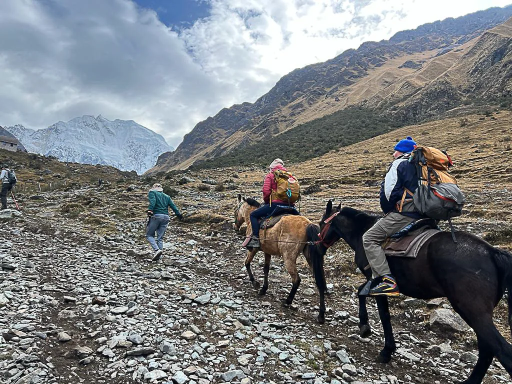
A word on the crew. Salkantay runs on horses and arrieros — horsemen — rather than the porter system of the Inca Trail, and the same ethical question applies. Animal condition is the tell: horses on a well-run trek are in good flesh, sensibly loaded and rested. If an operator’s price is far below the market, that saving is coming from somewhere, and on this route it usually comes off the animals or the arriero. Ask what the crew is paid and look at the horses on day one.
Your passport, for Machu Picchu entry and the train.
Our itinerary includes horse support for a duffel of personal gear, which changes the experience considerably. Carry only a day pack.
Walking It With the Mountain in Mind
You can do this trek as pure hiking and it will be a fine week. But you’ll spend two days directly beneath one of the most significant Apus in the southern Andes, and there’s a way to walk that with some awareness of what you’re walking through.
The apachetas. Cairns of stacked stones at the pass and other high points. These are not trail markers and they are not a game. Adding a stone is a gesture of acknowledgement to the Apu — a small act of ayni, reciprocity, from someone passing through territory that isn’t theirs. If you add one, add it deliberately and quietly. Don’t knock others over, don’t build decorative towers for photographs, and don’t take stones away.
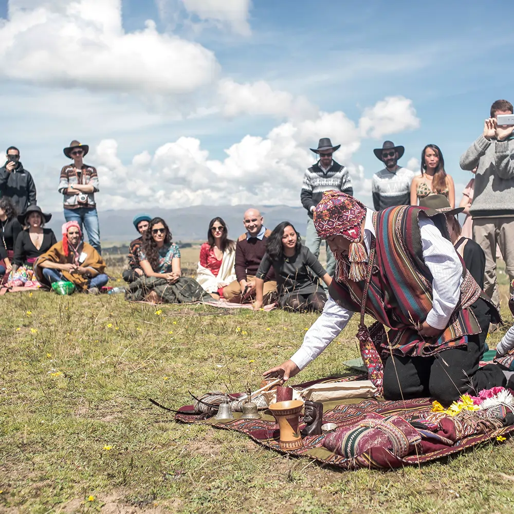
The k’intu. If your guide stops at the pass, arranges three coca leaves, breathes into them and offers them to the mountain, you are watching a live ritual, not a demonstration. Three whole leaves, faces up — a k’intu — and the breath is phukuy, the transfer of intention. Ask before photographing. Ask if you can participate. The answer is usually yes and the asking is the point.
Silence at the pass. Whatever else you do, don’t arrive shouting. Peruvian crews generally cross high passes quietly, and there’s a reason for it.
If you want to understand the practice rather than observe it, our guide to despacho ingredients explains what an offering to the Apus actually contains and why.
Ceremony Before or After the Trek
Most guests build their Cusco trip around the trek and add nothing. It’s the most common thing they tell us afterwards they’d change.
Before works well because you need the acclimatisation days anyway, and those days otherwise get spent wandering the Plaza de Armas. An hour with a master at a coca leaf reading, from $70, or a Pachamama offering at $350, means that when your guide places a k’intu at 4,650 m you know precisely what that gesture is.
After works even better for the plant medicines. You arrive fully acclimatised, physically emptied out, with a week of walking already in you — which several guests have described as the ideal preparation for a wachuma ceremony or an ayahuasca ceremony.
Never the day before or the day after. Wachuma leaves you dehydrated and tired for a day or two even when it goes beautifully, and starting up toward 4,650 m in that state moves from unpleasant into unsafe. Leave two clear days either side of the trek. The spacing logic — including why wachuma should precede ayahuasca and why neither should sit on consecutive days — is in our 7-day itinerary.
Plant medicine ceremonies require individual health screening and are excluded for cardiac conditions, pregnancy, epilepsy and a range of medications among others. The coca reading and the despacho carry no such restrictions and are open to almost anyone.
Mistakes We See
Booking it as the easy alternative to the Inca Trail. It is the harder route.
Starting within two days of landing in Cusco. The most reliable way not to finish.
Skipping poles. You will regret this on the afternoon of day two.
A summer sleeping bag. Soraypampa is not a summer campsite.
Trying to summit Salkantay. Nobody on the trek is going near the summit; it’s technical mountaineering.
Assuming the trek covers Machu Picchu fully. Circuit 2 leaves out the Temple of the Sun.
Flying out of Cusco the morning after finishing. Give yourself a day.
Treating apachetas as scenery. They’re in use.
Frequently Asked Questions
How difficult is the Salkantay trek?
Challenging. A 4,650 m pass, 22 km on the hardest day, roughly 2,600 m of total descent and three nights camping. Harder than the classic Inca Trail.
What is the Salkantay Pass altitude?
Around 4,600 m, with some operators including ours giving 4,650 m. It is the high point of the route.
How high is Salkantay mountain?
6,271 m, with sources giving 6,264 m and a 2013 GPS reading of 6,279 m. It is the highest peak in the Vilcabamba range and the twelfth highest in Peru.
Do I climb Salkantay on the trek?
No. The route crosses a pass on its flank. The summit is a technical mountaineering objective.
What does Salkantay mean?
It comes from the Quechua sallqa — wild, savage, uncivilised, invincible — usually rendered as “Savage Mountain.”
Do I need a permit for the Salkantay trek?
No. There is no daily quota, unlike the Inca Trail. Machu Picchu entry is booked separately and does sell out.
Salkantay or the Inca Trail?
Salkantay for the mountain and the ecosystems; the Inca Trail for the Inca road, the ridge-top ruins and the Sun Gate arrival. Salkantay is higher and harder.
Is Salkantay open in February?
Yes — it has no annual closure, unlike the Inca Trail. But February is the wettest month and the pass is unpleasant; we’d suggest the dry season.
How long is the Salkantay trek?
Roughly 58 km on our five-day itinerary, with longer variants reaching around 70 km.
How far ahead should I book?
Two to four weeks generally; six to eight for June to August.
Is there anywhere to shower?
Not on the trail. There’s a hotel in Aguas Calientes on night four, and hot springs at Cocalmayo or Aguas Calientes if you want them.
What’s the food like?
Better than you’d expect. Our itinerary includes twelve meals prepared by a cook who walks with the group.
Can I do it in four days?
Yes, by compressing days three and four. It makes an already hard trek harder and skips the coffee valley, which is a shame.
What We’d Tell You
Book Salkantay because you want to walk under a mountain called wild and come down the other side into coffee country. Not because the Inca Trail was full.
Give yourself three nights at altitude first. Bring poles and a warm bag. Go in May, September or October if you can choose. And when you reach the pass, put a stone on the cairn and stand there quietly for a minute before you get the camera out — the people who have lived under that mountain for centuries have a word for it, and wild is not a compliment or an insult. It’s a description of something you’re being allowed to cross.
Tell us your dates and we’ll tell you honestly whether this is your route.
Altitudes and distances are drawn from published sources and our own itinerary; figures vary between operators and should be treated as approximate. Prices are starting rates in US dollars, subject to change. High-altitude trekking carries real risk of altitude illness regardless of fitness — consult your physician before booking, particularly with any cardiac, respiratory, blood-pressure or joint condition. Parts of the route cross protected areas managed by SERNANP; archaeological sites including Llactapata and Machu Picchu are administered by Peru’s Ministerio de Cultura through the Dirección Desconcentrada de Cultura de Cusco. Elevation and etymology for Salcantay per published reference sources. Plant medicine ceremonies referred to here require individual health screening and are not suitable for everyone.