Power Places in Cusco: The Real Sacred Geography
 By PumAdventures
Spend three days in Cusco and somebody will offer you a vortex tour.
It will be described as ancient, Inca, energetic. You’ll be told about convergence points, ley lines, portals. And it will be sold to you with complete confidence, usually by someone who has never been asked where the idea came from.
So here is where it came from. The word vortex, in this sense, was coined by Page Bryant, a psychic from Florida, around 1979–1980. According to the Sedona Heritage Museum, Bryant “psychically encountered Albion, an entity who described several different energy spots in Red Rock Country” in Arizona. She began running workshops and tours, the idea spread, and over the following decades it was exported to spiritual destinations worldwide — including here.
It is about forty-five years old and it is from Arizona.
None of which makes it worthless to the people who find meaning in it. But selling it in Cusco as Inca tradition is a different matter, and it displaces something considerably more interesting: Cusco has a real, documented, catalogued sacred geography, recorded by name in the sixteenth century and mapped archaeologically in the twentieth. The Inca had a numbered register of power places in Cusco — roughly 328 of them, organised along 41 lines radiating from a single temple, each with a named group responsible for its upkeep.
Nobody needs to invent portals for a city like that.
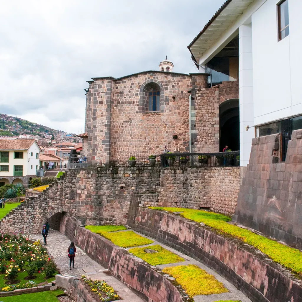
Table of Contents
First: What a Huaca Actually Is
Before the lines, the things the lines connected.
A huaca — wak’a in Quechua — is usually translated as “sacred site” or “shrine,” and both translations are misleading. The register of Cusco huacas includes standing stones, springs, caves, hills, fields, bridges, tombs, houses, carved outcrops, stretches of river, trees, and the mummified bodies of former rulers. Some were monumental. Many were, to an outside eye, unremarkable.
The category is not “impressive place.” It is closer to “being with a presence.” Andean understanding held that such an object possessed camaquen — animating spirit — and could be addressed, fed, consulted and offended. A boulder was not a symbol of something sacred. The boulder was the sacred thing.
That distinction matters for how you walk around Cusco. The rock outcrop behind a housing estate in San Sebastián may have been a named huaca on a specific ceque with a specific family responsible for offering to it, and it may look like a rock. Our overview of Andean rituals sets out the framework that makes sense of this, and the same logic governs the mountains — covered in our piece on the Apus.
The two are related but distinct. The Apus are the great mountain beings, addressed from wherever you stand. The huacas are the specific, enumerated places of the Cusco valley, and they were organised into a system. That system is the subject of this article.
Why the Coricancha Was the Zero Point
Everything above counts outward from one building, so it’s worth knowing what that building was.
The Coricancha — Qorikancha, the golden enclosure — was the principal temple of the Inca state. Colonial accounts describe walls sheeted in gold, a garden of gold and silver plants, and chambers dedicated to the sun, the moon, thunder, the rainbow and the stars. The mummified bodies of former rulers were kept and attended there.
It was also, structurally, the point from which Cusco was organised. The four suyus met here. The four great roads of the Qhapaq Ñan set out from the city with reference to it. And the forty-one ceques were counted from its walls.
So the ceque system was not a spiritual overlay on a city that existed for other reasons. The city and the system were the same design. Cusco was reportedly laid out to be read as a whole — the qosqo, the navel — and the lines radiating from the temple were how that reading was organised.
What survives today is the stonework: curved walls of fitted ashlar, some of the finest in the Andes, with a Dominican convent built on top of them. The gold went in the ransom of Atahualpa. The chambers are still there and you can stand in them.
Go here first. Not because it’s the most spectacular site in Cusco — Sacsayhuamán is — but because the rest of the geography only makes sense once you’ve stood at the centre of it.
Power Places in Cusco: The Ceque System Explained
Here is the thing itself.
The lines
From the Coricancha — the Temple of the Sun at the centre of Cusco, whose walls still stand beneath the Santo Domingo convent — forty-one ritual lines radiated outward across the valley and beyond. These were the ceques.
Strung along them were approximately 328 huacas, each named, each in a fixed sequence along its line, each with prescribed offerings.
Sit with that for a moment. Not a vague sense that certain places feel special. A register. Lines numbered, shrines listed in order, offerings specified, responsibility assigned.
The four suyus
The ceques were grouped by the four quarters of the empire, radiating from Cusco as the navel:
Chinchaysuyu to the north-west. Antisuyu to the north-east, toward the jungle. Collasuyu to the south-east, toward Titicaca. Cuntisuyu to the south-west, toward the coast.
Each quarter held a set of ceques. Cuntisuyu is the anomaly — it expanded to fourteen ceques, a detail generally read as accommodating the empire’s southern conquests, which tells you the system was living rather than frozen.
Hanan and Hurin
Cusco was also divided into moieties — Hanan Cusco, the upper half, and Hurin Cusco, the lower — a dual organisation that ran through Inca society at every level.
The ceques split accordingly, and unevenly: Hanan held 15 ceques with 109 huacas; Hurin held 26 ceques with 219 huacas.
That asymmetry is itself informative. This was not a tidy diagram imposed on a landscape. It was a social map that recorded real relationships between real groups.
Who kept them
The part that turns an abstraction into something human.
Each ceque was assigned to a kin group — a panaca (a royal lineage descended from a particular ruler) or an ayllu (a community kin group). That group was responsible for the huacas on its line: making the offerings, at the right times, in the right form.
So the system was simultaneously a religious map, a calendar of obligations, and a register of who owed what to whom. Maintaining your ceque was how your lineage held its place in the city. Our guide to despacho offerings describes the kind of offering involved, and the practice has not stopped.
The Calendar Hypothesis
Now the argument that made the ceque system famous among scholars — and where we start labelling carefully.
Documented: the count of roughly 328 huacas.
Interpretation — influential, and contested: the anthropologist R. Tom Zuidema observed that 328 is not an arbitrary number. It is exactly twelve sidereal lunar months: 12 × 27⅓ = 328.
A sidereal month is the moon’s return to the same position against the fixed stars — about 27.3 days — as distinct from the synodic month of phases, about 29.5 days. Zuidema argued that each huaca corresponded to a day, making the ceque system a calendar written across a landscape: you tracked the year by moving through the shrines in sequence.
He further argued that the system integrated solar zenith passages and December solstice observations with specific lunar months, producing something closer to a working almanac than a symbolic diagram.
Why be careful with this. It is an elegant argument and it is an interpretation of a number. Scholars differ over how literally to take it, and the 328 figure itself comes from a colonial source that may have tidied what it recorded. Treat the calendar reading as the most influential hypothesis about the system rather than as settled fact.
And note that it doesn’t matter much for the main point. Whether or not the huacas doubled as days, the register existed. That is the part nobody has to argue about.
How We Know Any of This
The evidence base, because the claim “the Inca had a catalogue of 328 sacred places” invites the obvious question.
Polo de Ondegardo, 1559. A Spanish colonial administrator whose report describes the forty-one lines radiating from the Coricancha. He was, notably, investigating Andean religion in order to suppress it.
Bernabé Cobo, 1653. His Historia del Nuevo Mundo contains the most systematic enumeration — the ceques listed one by one, the huacas named along each, with descriptions and prescribed offerings. Cobo was working from earlier material, Polo’s included.
Felipe Guamán Poma de Ayala, c. 1615. The Nueva corónica y buen gobierno, written by an Andean author, supplies context from inside the tradition.
Then the modern work. John H. Rowe emphasised how the system unified the city administratively and ritually. Zuidema produced the calendrical reading. And Brian S. Bauer went looking for the shrines on the ground, surveying the Cusco valley between 1990 and 1995 and publishing the results as The Sacred Landscape of the Inca: The Cusco Ceque System with University of Texas Press in 1998 — the standard reference, and the work that moved the ceques from a colonial text to a map.
The uncomfortable part. We possess this record because Spanish administrators compiled it as an inventory for the extirpation of idolatries. The catalogue exists because someone needed a list of what to destroy. Much of what it names was subsequently dismantled, built over, or quietly abandoned — and the Coricancha itself has a Dominican convent on top of it.
What Happened to It
The system did not fade. It was dismantled.
From the later sixteenth century onward, colonial campaigns known as the extirpation of idolatries set out to identify and destroy Andean religious practice. Huacas were broken, burned, buried or built over. Churches went up on temple foundations — the Coricancha and Santo Domingo being the most visible example, and far from the only one. Practitioners were prosecuted.
The registers compiled by Polo de Ondegardo and used by Cobo were part of that machinery. We can reconstruct the ceque system today because somebody needed an inventory of what to eliminate.
But the thing about a network of three hundred and twenty-eight places maintained by dozens of family groups is that it is very difficult to eliminate completely. What happened instead is the pattern across the Andes: the practice went domestic, went quiet, and acquired a Catholic surface.
Offerings did not stop. They stopped being public. A family that had maintained a huaca continued to make offerings to the ground, and over generations that obligation detached from the specific registered shrine and attached to the land itself, the local Apu, the household. That is broadly the practice you encounter in Chinchero today — the despacho, the k’intu, the naming of mountains on the horizon.
So the honest description of what survives is not “ruins.” It is a catalogue that was mostly destroyed, and a practice that mostly wasn’t.
Which is why an offering built by a paqo in a courtyard above Chinchero has more continuity with the ceque system than any stone you can photograph.
What Survives, and What You Can Visit
Honest answer first: most of the 328 are gone or unlocatable. Cusco is a living city and has been for eight hundred years; a named boulder in a field in 1559 may now be under a road. Bauer’s survey identified a substantial proportion but far from all.
These are the ones still standing, and they are worth visiting as a system rather than as a list.
Coricancha — the centre
Everything radiates from here. The Inca stonework is still visible inside and beneath the colonial church, and standing in the courtyard you are at the point from which all forty-one lines were counted.
Go first. The rest only makes sense from here.
Sacsayhuamán
The vast terraced complex above the city, on Chinchaysuyu ground. Its function is debated — fortress, temple, ceremonial space, probably all three — and its megalithic walls are the single most impressive surviving Inca construction in the region. We’ve written about it separately as the temple of lightning.
Q’enqo
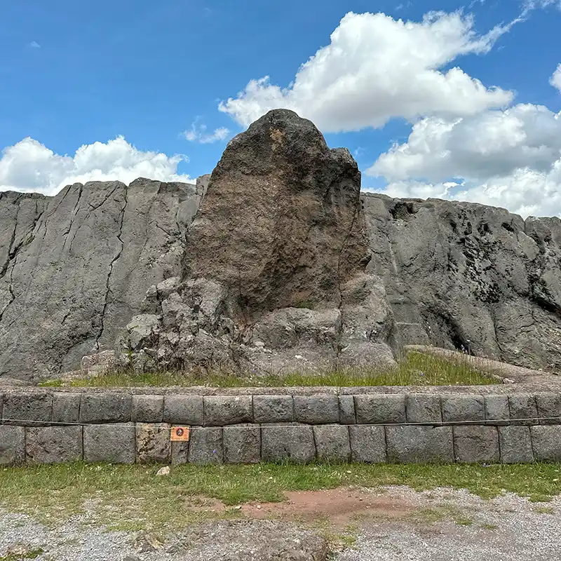
Ten minutes further up. A carved limestone outcrop riddled with channels, a zigzag groove that gives the site its name — q’enqo, labyrinth or zigzag — and a subterranean chamber with a carved altar.
This is the clearest surviving example of what a huaca actually was: the rock itself is the shrine. Nothing was built here. The living stone was worked, and that working is the sacred act.
Tambomachay
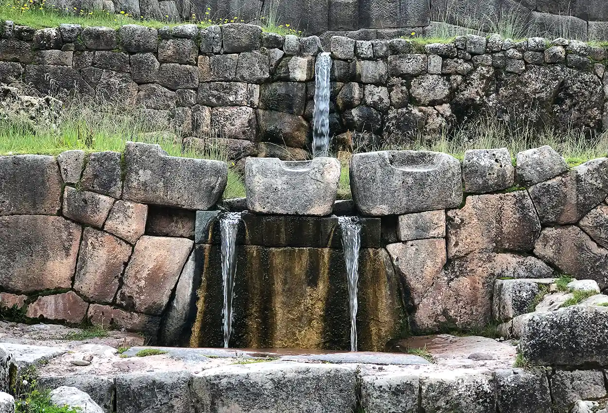
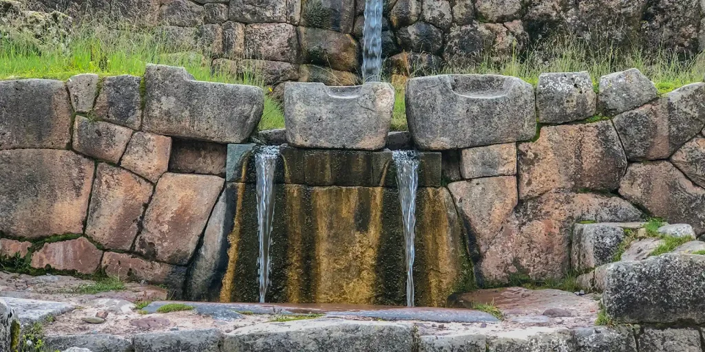
A three-tiered water shrine where a spring emerges and is channelled through cut stone into a sequence of falls. Still running. Still exactly as engineered.
Water shrines recur throughout Inca sacred architecture — Wiñay Wayna on the Inca Trail, the sixteen fountains at Machu Picchu, which we cover in Machu Picchu’s sacred architecture. Tambomachay is where you can see the principle in its purest form.
Puka Pukara
Across the road from Tambomachay. Reddish stone, usually described as a checkpoint or waystation on the road toward Antisuyu. Less spectacular than the others and useful precisely because it shows that the network mixed the administrative and the sacred without much of a boundary.
The ones almost nobody visits
Inkilltambo, in a ravine east of the city, with carved outcrops and terraces and generally nobody there. Salonpunku, often called the Temple of the Moon, a carved cave complex beyond Sacsayhuamán with a stone altar inside and extraordinary acoustics. Chakan, a water site to the west with carvings and a small waterfall.
All three are reachable on foot from Cusco, all three are free or nearly so, and on a weekday you may well have them to yourself. Our piece on unbeaten paths in Cusco covers more of this territory, and our roundup of the best sacred sites in Cusco sets out the fuller list.
Visiting Them as a System, Not a Checklist
The standard city tour drives you between four sites in three hours and tells you Sacsayhuamán means “satisfied falcon.” You will learn almost nothing about how they relate.
The radial logic is the point. These places were not independent attractions. They were positions on lines counted from one centre, and walking outward from the Coricancha rather than being bussed between stops makes the geometry legible in a way no amount of explanation does.
A practical version: start at the Coricancha. Walk up through San Blas to Sacsayhuamán — it’s steep and it takes about forty minutes and it is the correct way to approach it. Continue to Q’enqo, then on to Puka Pukara and Tambomachay along the road, or drop into the Inkilltambo ravine if you want quiet instead.
Our walking route through Cusco’s sacred sites sets this out properly with timings and altitudes. If you’d rather not walk it, the city tour covers the four main sites, and our page on the city of Cusco gives the wider context.
One practical note: most of these sites sit inside the boleto turístico, the combined ticket. Check which version you need before setting out; the partial tickets don’t all cover the same sites.
What About the Sacred Valley?
A reasonable question, because the “energy places Sacred Valley” searches are constant.
The ceque system was Cusco-centred. It radiated from the Coricancha across the valley of Cusco and beyond, and some ceques extended a considerable distance — but it was not a map of the Sacred Valley, and nobody should tell you Pisac or Ollantaytambo were “on a ley line from Cusco” as though that were a documented thing.
The Sacred Valley has its own sacred geography, organised around its own Apus and its own sites. Pisac with its Intihuatana, Moray as a form of womb, Ollantaytambo under Apu Pinkuylluna, Chinchero as the birthplace of the rainbow. We cover those in Sacred Valley spiritual sites.
Different system, same logic: specific places, specific relationships, specific beings — not a generic energy field.
What This Is and Isn’t
The boundaries, stated plainly, because an article debunking one set of claims should be careful not to smuggle in another.
Nobody has measured anything. There is no instrument reading that distinguishes a huaca from the ground beside it. The claim here is historical and archaeological: these places were named, catalogued and maintained. That is a claim about people, not about physics.
The ceques were social and political as much as devotional. Assigning a line to a panaca was a way of fixing that lineage’s standing. Reading the system as pure mysticism strips out most of what it was doing.
The 328 figure comes from colonial sources. Written by outsiders, decades after the conquest, for purposes of suppression. Bauer’s fieldwork gave it a firm archaeological footing, but the underlying register was compiled by people who did not believe in it.
Don’t perform ceremonies at huacas yourself. You will see visitors doing it — hands on stones, improvised offerings, small fires. These are protected archaeological sites administered by Peru’s Ministerio de Cultura through the Dirección Desconcentrada de Cultura de Cusco, and beyond the legal point, assembling a ritual from things you read is exactly the superficial appropriation that the people who carry this tradition object to.
If you want to make an offering, sit with someone who holds the practice. A coca leaf reading from $70 or a Pachamama offering at $350, with a master from Chinchero, is the difference between participating in a living tradition and playing at one. Our article on what a coca leaf reading means explains what that actually involves.
And nothing here requires belief. You can find the ceque system one of the most remarkable pieces of landscape organisation in the pre-modern world while holding no view at all about camaquen.
Frequently Asked Questions
What are the power places in Cusco?
Historically, the huacas of the ceque system: roughly 328 named shrines — rocks, springs, caves, hills, buildings — arranged along 41 lines radiating from the Coricancha. Surviving, visitable examples include Sacsayhuamán, Q’enqo, Tambomachay, Puka Pukara and Inkilltambo.
Is there a vortex in Cusco?
Not in any Andean sense. The vortex concept was coined by a psychic in Arizona around 1979–1980 and exported to spiritual destinations later. Cusco’s own sacred geography is documented and considerably more specific.
What is the ceque system?
Forty-one ritual lines radiating from the Coricancha in Cusco, organising about 328 huacas across the landscape, divided among the four suyus and the Hanan and Hurin moieties, with each line maintained by a named kin group.
What does huaca mean?
From Quechua wak’a — a place or object understood to hold animating spirit. Not a monument in the Western sense; a being that can be addressed, fed and offended.
How many huacas were there in Cusco?
Approximately 328, according to the colonial registers. Many no longer survive or cannot be located.
Is the ceque system a calendar?
It’s the leading interpretation. Zuidema noted that 328 equals twelve sidereal lunar months (12 × 27⅓), and argued each huaca marked a day. Influential, and debated.
Who documented the ceque system?
Polo de Ondegardo in 1559 and Bernabé Cobo in 1653, with Guamán Poma providing Andean context around 1615. Brian Bauer surveyed the shrines archaeologically between 1990 and 1995.
Can I still see the ceque lines?
Not as lines on the ground — they were conceptual sightlines rather than roads. You can visit surviving huacas along them.
Are there ceques in the Sacred Valley?
The system was centred on Cusco. The Sacred Valley has its own sacred geography rather than being an extension of the Cusco ceques.
Can I do a ceremony at Sacsayhuamán or Q’enqo?
No. They are protected archaeological sites with restrictions on offerings, fires and gatherings. Arrange a ceremony with a practitioner on appropriate ground instead.
What’s the best way to see these sites?
On foot, outward from the Coricancha, in the order the system implies — rather than bussed between four stops in three hours.
Why did the Coricancha matter so much?
It was the principal temple of the Inca state, the point where the four suyus met, and the origin from which all forty-one ceques were counted. Its walls still stand beneath the Santo Domingo convent.
What happened to the huacas?
Most were destroyed, buried or built over during the colonial extirpation of idolatries. The registers that describe them were compiled as part of that campaign.
Did the practice survive?
The catalogue largely didn’t; the practice largely did. Offerings went domestic and continue today in the despacho tradition of communities like Chinchero.
Do I need the boleto turístico?
For most of the main sites, yes. Check which version covers what before setting out — the partial tickets differ. Inkilltambo, Salonpunku and Chakan are generally free or nearly so.
Why the Real Thing Is Better
The vortex story asks you to believe that certain spots emit an energy that instruments can’t detect, on the authority of a psychic from Florida who was told about it by an entity called Albion.
The ceque system asks you to believe that a pre-industrial state organised a mountain valley into forty-one lines and three hundred and twenty-eight named shrines, assigned each line to a family, specified what each shrine was owed and when, and possibly ran the calendar off it — and it asks you to believe this on the authority of two colonial registers, an Andean chronicler, and five years of archaeological survey.
One of those is a better story. It also happens to be true.
Go and stand in the Coricancha courtyard, and then walk uphill to Q’enqo and put your hand on a rock that somebody’s ancestors carved channels into so that chicha would run the right way. You won’t need anybody to tell you it’s a power place.
Tell us your dates and we’ll build a few days around the ones worth seeing.Historical claims here follow published scholarship on the Cusco ceque system, principally the colonial accounts of Polo de Ondegardo (1559) and Bernabé Cobo (1653) and the archaeological survey published by Brian S. Bauer as The Sacred Landscape of the Inca: The Cusco Ceque System (University of Texas Press, 1998). The calendrical interpretation associated with R. Tom Zuidema is presented as interpretation rather than settled fact. Archaeological sites in the Cusco region are administered by the Ministerio de Cultura through the Dirección Desconcentrada de Cultura de Cusco; offerings, fires and gatherings at these sites are restricted. On the origin of the vortex concept, see KJZZ’s account drawing on the Sedona Heritage Museum. No claim is made here about measurable physical properties at any location.